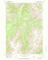
1970 Map of Hardluck Mountain
USGS Topo · Published 1973About this map
The South Fork Shoshone River carves through high-elevation terrain in this 1970 survey of the Absaroka Range, marking a landscape defined by the Shoshone National Forest and the Washakie Wilderness. The topography is dominated by massive features like Hardluck Mountain and Ash Mountain to the north, while the southern portion of the map is occupied by the expansive Shoshone Plateau.
Find a feature on this map
16 named features on this map. Tap any name to fly to it.
Don’t see what you’re looking for? This feature index may not catch every label — zoom into the map to look around manually.
Map Details
Editions of this 1970 Hardluck Mountain Map
2 editions found
Other maps of this area

1893 · Ishawooa
USGS Topo · 1:125,000

1895 · Ishawooa
USGS Topo · 1:125,000

1899 · Ishawooa
USGS Topo · 1:125,000

1905 · Younts Peak
USGS Topo · 1:125,000

1907 · Younts Peak
USGS Topo · 1:125,000

1955 · Cody
USGS Topo · 1:250,000

1955 · Thermopolis
USGS Topo · 1:250,000

1956 · Shoshone Pass
USGS Topo · 1:24,000

1956 · Snow Lake
USGS Topo · 1:24,000

1956 · Five Pockets
USGS Topo · 1:24,000