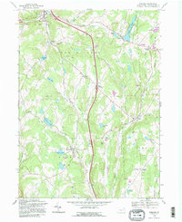
1992 Map of Harford
USGS Topo · Published 1995About this map
The borough of New Milford and the historic village of Harford anchor this detailed study of Susquehanna County's northeastern landscape. Situated in the heart of the Endless Mountains, the terrain is defined by a dense network of upland valleys and named hills like Mott Hill and Wolf Hill. The settlement pattern follows a distinct crossroads logic, as seen in the cluster of familial place names such as Moxley Corners, Tyler Corners, and Steinbachs Corners.
Find a feature on this map
43 named features on this map. Tap any name to fly to it.
Don’t see what you’re looking for? This feature index may not catch every label — zoom into the map to look around manually.
Map Details
Editions of this 1992 Harford Map
2 editions found
Other maps of this area

1892 · Dundaff
USGS Topo · 1:62,500

1932 · Susquehanna
USGS Topo · 1:62,500

1935 · Susquehanna
USGS Topo · 1:62,500

1943 · Montrose
USGS Topo · 1:62,500

1945 · Montrose
USGS Topo · 1:62,500

1946 · Tunkhannock
USGS Topo · 1:62,500
1946 · Clifford
USGS Topo · 1:24,000

1946 · Hop Bottom
USGS Topo · 1:24,000
1946 · Lenoxville
USGS Topo · 1:24,000

1947 · Hopbottom
USGS Topo · 1:24,000