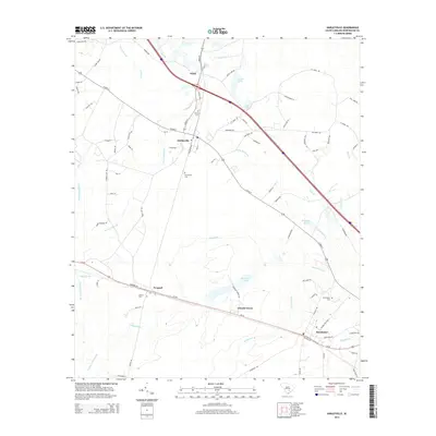
2014 Map of Harleyville
USGS Topo · Published 2014About this map
Harleyville stands as a central junction in this South Carolina landscape, where a web of local roads like W Main St and S Railroad Ave meet the regional transport corridors of the Southern railroad line and modern highways. The settlement patterns follow these transit veins, connecting the town to surrounding communities like Dorchester, Pregnall, and the aptly named industrial site at Giant.
Find a feature on this map
90 named features on this map. Tap any name to fly to it.
Don’t see what you’re looking for? This feature index may not catch every label — zoom into the map to look around manually.
Map Details
Editions of this 2014 Harleyville Map
This is the sole edition of this map. No revisions or reprints were ever made.
Other maps of this area

1919 · Ridgeville
USGS Topo · 1:48,000

1920 · Eutawville
USGS Topo · 1:48,000

1920 · Bowman
USGS Topo · 1:48,000

1920 · Ridgeville
USGS Topo · 1:62,500

1920 · St. George
USGS Topo · 1:48,000

1921 · Bowman
USGS Topo · 1:62,500

1921 · St. George
USGS Topo · 1:62,500

1921 · Eutawville
USGS Topo · 1:62,500

1943 · Bowman
USGS Topo · 1:62,500

1943 · Orangeburg
USGS Topo · 1:125,000