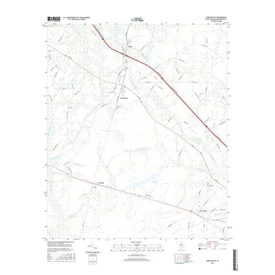
2017 Map of Harleyville
USGS Topo · Published 2017About this map
Harleyville and the surrounding Dorchester County countryside appear here as a landscape defined by its low-lying wetlands and persistent rail and road connections. The map shows a clear linear settlement pattern following the corridors of Highway 178 and the railroad, which link the communities of Pregnall and Dorchester. This era reveals a region where water management and drainage are central to the terrain, evidenced by the extensive network of branches and swamps such as Indian Field Swamp and Walnut Branch. For genealogists, the map provides precise locations for several local burial sites, including Mount Zion Cem near the community of Giant, and Calvary Cem situated south of the railroad line. The presence of specialized features like Railroad Pond and the complex naming of local water bodies like Little Walnut Br reflect the historical importance of water resources to this part of South Carolina.
Find a feature on this map
95 named features on this map. Tap any name to fly to it.
Don’t see what you’re looking for? This feature index may not catch every label — zoom into the map to look around manually.
Map Details
Editions of this 2017 Harleyville Map
This is the sole edition of this map. No revisions or reprints were ever made.
Other maps of this area

1919 · Ridgeville
USGS Topo · 1:48,000

1920 · Eutawville
USGS Topo · 1:48,000

1920 · Bowman
USGS Topo · 1:48,000

1920 · Ridgeville
USGS Topo · 1:62,500

1920 · St. George
USGS Topo · 1:48,000

1921 · Bowman
USGS Topo · 1:62,500

1921 · St. George
USGS Topo · 1:62,500

1921 · Eutawville
USGS Topo · 1:62,500

1943 · Bowman
USGS Topo · 1:62,500

1943 · Orangeburg
USGS Topo · 1:125,000