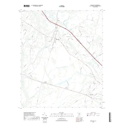
2020 Map of Harleyville
USGS Topo · Published 2020About this map
Harleyville serves as the central hub of this Dorchester County landscape, situated at the intersection of local routes and the railroad corridor. The area's geography is defined by an extensive network of blackwater drainage systems, including the wide Indian Field Swamp and numerous branches like Walnut Branch and Coldwater Br. These waterways historically dictated the patterns of settlement and agriculture, leaving a map marked by small, dispersed communities such as Pregnall, Dorchester, and the industrial-tinged Giant. Genealogists will find a cluster of significant burial sites including Mount Zion Cem and the Harleyville Cem, which anchor the local history of these rural townships. The map details a transition from the structured street plan of Harleyville to the winding country roads like Byrd Cemetery Rd and Sandridge Rd, illustrating the persistence of late-20th-century rural South Carolina land use.
Find a feature on this map
99 named features on this map. Tap any name to fly to it.
Don’t see what you’re looking for? This feature index may not catch every label — zoom into the map to look around manually.
Map Details
Editions of this 2020 Harleyville Map
This is the sole edition of this map. No revisions or reprints were ever made.
Other maps of this area

1919 · Ridgeville
USGS Topo · 1:48,000

1920 · Eutawville
USGS Topo · 1:48,000

1920 · Bowman
USGS Topo · 1:48,000

1920 · Ridgeville
USGS Topo · 1:62,500

1920 · St. George
USGS Topo · 1:48,000

1921 · Bowman
USGS Topo · 1:62,500

1921 · St. George
USGS Topo · 1:62,500

1921 · Eutawville
USGS Topo · 1:62,500

1943 · Bowman
USGS Topo · 1:62,500

1943 · Orangeburg
USGS Topo · 1:125,000