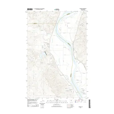
2014 Map of Harmon
USGS Topo · Published 2014About this map
The Harmon settlement area, situated near the intersection of several county boundaries, occupies a strategic position west of the Missouri River in this 2014 survey. The landscape is defined by the winding paths of Square Butte Creek and Otter Cr, which carve through the terrain as they flow toward the river. This modern era topographic study illustrates the transition from traditional rural land use to a more structured residential network, with family-named routes and local roads like Harmon Lake Rd and Otter Creek Rd N providing access to the river bluffs. The convergence of Oliver, Morton, and Burleigh counties in this small corridor highlights its significance as a multi-jurisdictional geographic hub along the river valley north of the state capital region.
Find a feature on this map
61 named features on this map. Tap any name to fly to it.
Don’t see what you’re looking for? This feature index may not catch every label — zoom into the map to look around manually.
Map Details
Editions of this 2014 Harmon Map
This is the sole edition of this map. No revisions or reprints were ever made.
Other maps of this area

1907 · Bismarck
USGS Topo · 1:125,000

1950 · Wilton
USGS Topo · 1:62,500

1950 · Bismarck
USGS Topo · 1:24,000

1951 · Bismarck
USGS Topo · 1:62,500

1951 · Mandan
USGS Topo · 1:24,000

1954 · Bismarck
USGS Topo · 1:250,000

1954 · McClusky
USGS Topo · 1:250,000

1958 · Bismarck
USGS Topo · 1:250,000

1958 · McClusky
USGS Topo · 1:250,000

1962 · Bismarck
USGS Topo · 1:24,000