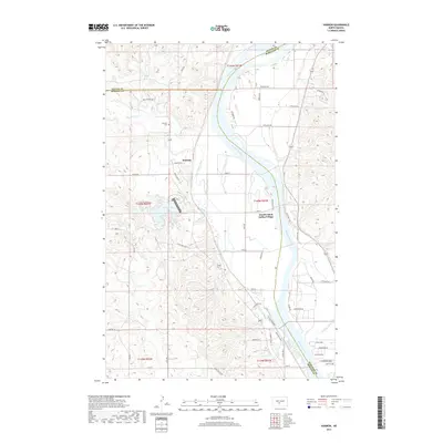
2017 Map of Harmon
USGS Topo · Published 2017About this map
Double Ditch Indian Village sits prominently on the eastern bank of the Missouri River, marking an area of profound historical significance where the river creates a wide floodplain. The small settlement of Harmon is located to the west, supported by the modern recreational waters of Harmon Lake and the drainage of Square Butte Cr. This landscape is defined by the meeting of three counties—Oliver, Morton, and Burleigh—at a point just north of the lake. The terrain features a mix of river-bottom lands and rising bluffs, with Otter Cr winding through the southern portion of the quadrangle before its confluence. Genealogists may find interest in the Harmon Cem, which remains a central landmark for the local community. The map also traces the winding Horseshoe Bend of the river, illustrating the shifting course of this major waterway and its impact on local property boundaries and access roads like State HWY 1804.
Find a feature on this map
53 named features on this map. Tap any name to fly to it.
Don’t see what you’re looking for? This feature index may not catch every label — zoom into the map to look around manually.
Map Details
Editions of this 2017 Harmon Map
This is the sole edition of this map. No revisions or reprints were ever made.
Other maps of this area

1907 · Bismarck
USGS Topo · 1:125,000

1950 · Wilton
USGS Topo · 1:62,500

1950 · Bismarck
USGS Topo · 1:24,000

1951 · Bismarck
USGS Topo · 1:62,500

1951 · Mandan
USGS Topo · 1:24,000

1954 · Bismarck
USGS Topo · 1:250,000

1954 · McClusky
USGS Topo · 1:250,000

1958 · Bismarck
USGS Topo · 1:250,000

1958 · McClusky
USGS Topo · 1:250,000

1962 · Bismarck
USGS Topo · 1:24,000