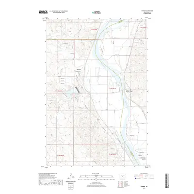
2020 Map of Harmon
USGS Topo · Published 2020About this map
Double Ditch Indian Village stands as a prominent archaeological landmark on the eastern banks of the Missouri River, marking a site of significant ancestral importance. Across the water, the settlement of Harmon and the nearby Harmon Cem provide a focal point for local genealogy in this corner of North Dakota. The landscape is defined by the winding course of Square Butte Creek and the recreational waters of Harmon Lake, which sits tucked into the drainage of Otter Cr. This 2020 survey reveals a rural network where modern residential roads like Bluestem Dr N and Crested Dr N branch off from the primary corridor of State Hwy 1806, illustrating the continued habitation and gradual development along the river bluffs north of the Mandan area.
Find a feature on this map
53 named features on this map. Tap any name to fly to it.
Don’t see what you’re looking for? This feature index may not catch every label — zoom into the map to look around manually.
Map Details
Editions of this 2020 Harmon Map
This is the sole edition of this map. No revisions or reprints were ever made.
Other maps of this area

1907 · Bismarck
USGS Topo · 1:125,000

1950 · Wilton
USGS Topo · 1:62,500

1950 · Bismarck
USGS Topo · 1:24,000

1951 · Bismarck
USGS Topo · 1:62,500

1951 · Mandan
USGS Topo · 1:24,000

1954 · Bismarck
USGS Topo · 1:250,000

1954 · McClusky
USGS Topo · 1:250,000

1958 · Bismarck
USGS Topo · 1:250,000

1958 · McClusky
USGS Topo · 1:250,000

1962 · Bismarck
USGS Topo · 1:24,000