2024 Map of Harmon
USGS Topo · Published 2024About this map
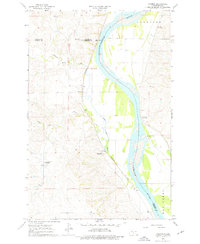
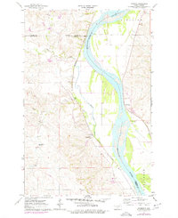
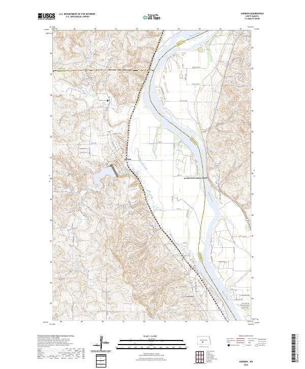
The Missouri River serves as the dominant geographic feature of this section of North Dakota, carving a wide valley through the plains. Along its eastern banks, the Double Ditch Indian Village represents a significant archeological site, indicating a long history of habitation before modern settlement. Across the river to the west, the community of Harmon is situated near the confluence where Square Butte Creek and Otter Creek meet the main river channel. The landscape is characterized by its agricultural layout, marked by section lines and township boundaries such as t140n r81w and t139n r82w. Local history is anchored by the Harmon Cem and a network of rural roads like River Rd and Otter Creek Rd N that follow the natural topography of the river bluffs.
Find a feature on this map
62 named features on this map. Tap any name to fly to it.
Don’t see what you’re looking for? This feature index may not catch every label — zoom into the map to look around manually.
Map Details
Editions of this 2024 Harmon Map
This is the sole edition of this map. No revisions or reprints were ever made.