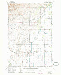
1958 Map of Harrah
USGS Topo · Published 1985About this map
The agricultural landscape of the Yakima Valley unfolds in this mid-century survey, defined by a complex irrigation network that transformed the arid terrain. Centered on Harrah, the map details a community deeply integrated with the Northern Pacific railroad line, which passes through the heart of town and continues east toward Farron. This rail corridor, mirrored by the Branch Road, served as the primary artery for moving produce from the surrounding fields.
Find a feature on this map
75 named features on this map. Tap any name to fly to it.
Don’t see what you’re looking for? This feature index may not catch every label — zoom into the map to look around manually.
Map Details
Editions of this 1958 Harrah Map

Other maps of this area

1899 · Ellensburg
USGS Topo · 1:125,000

1901 · Ellensburg
USGS Topo · 1:125,000

1910 · Zillah
USGS Topo · 1:125,000

1936 · Yakima East
USGS Topo · 1:48,000

1937 · White Swan
USGS Topo · 1:125,000

1941 · Yakima East
USGS Topo · 1:62,500

1950 · Yakima
USGS Topo · 1:250,000

1953 · Yakima East
USGS Topo · 1:24,000
1953 · Yakima East
USGS Topo · 1:62,500

1958 · Toppenish SW
USGS Topo · 1:24,000