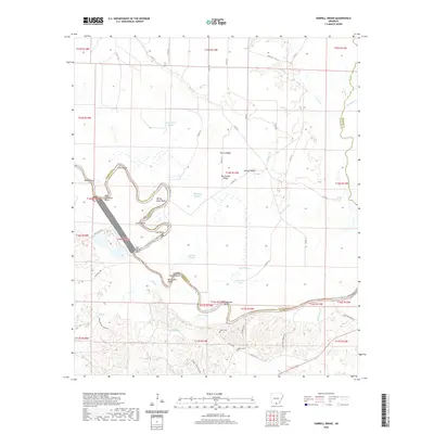
2020 Map of Harrell Brake
USGS Topo · Published 2020About this map
The Ouachita River defines the landscape of this region along the border of Union and Calhoun counties, winding through a complex of oxbows and backwaters. The river's serpentine path is marked by distinctive features such as Bells Ginhouse Bend, Dutch Bend, and Salt Spring Bend, reflecting the hydrologic history of the bottomlands. These low-lying areas are rich in secondary water features, including Harrell Brake, Grapevine Lake, and numerous sloughs like Birdseye Slough and McClain Slough.
Find a feature on this map
70 named features on this map. Tap any name to fly to it.
Don’t see what you’re looking for? This feature index may not catch every label — zoom into the map to look around manually.
Map Details
Editions of this 2020 Harrell Brake Map
This is the sole edition of this map. No revisions or reprints were ever made.
Other maps of this area

1927 · El Dorado
USGS Topo · 1:62,500

1930 · El Dorado
USGS Topo · 1:62,500

1933 · Strong
USGS Topo · 1:62,500

1934 · Moro Bay
USGS Topo · 1:62,500

1937 · Strong
USGS Topo · 1:62,500

1938 · Moro Bay
USGS Topo · 1:62,500

1939 · Moro Bay
USGS Topo · 1:62,500

1939 · Strong
USGS Topo · 1:62,500

1951 · El Dorado
USGS Topo · 1:62,500

1953 · El Dorado
USGS Topo · 1:250,000