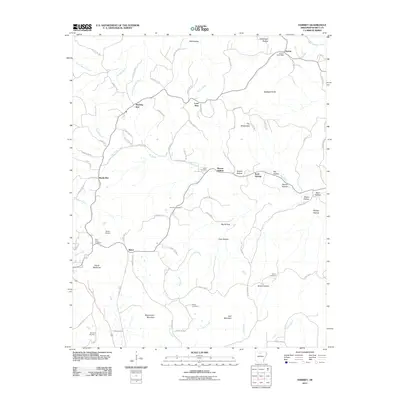
2011 Map of Harriet
USGS Topo · Published 2011About this map
The Harriet Post Office serves as the focal point for this rural pocket of Searcy County, where high ridges and deeply cut hollows dictate the layout of roads and settlements. Community life is anchored by a series of family and local burial grounds, including the Cypert Cemetery, Shiloh Cemetery, and Red Hill Cemetery, which are scattered throughout the landscape near small crossroads such as Morning Star and Baker. The topography is defined by prominent elevations like Blackjack Knob and Stephenson Mountain, with the interior area known as The Wilderness suggesting the dense, unpopulated character of the timberland between the forks of Big Creek and Davis Creek. This 2011 survey reveals a persistent rural pattern where modern county roads follow the winding contours of ancient drainages like Barren Hollow and Mill Hollow.
Find a feature on this map
88 named features on this map. Tap any name to fly to it.
Don’t see what you’re looking for? This feature index may not catch every label — zoom into the map to look around manually.
Map Details
Editions of this 2011 Harriet Map
This is the sole edition of this map. No revisions or reprints were ever made.
Other maps of this area

1890 · Mountain Home
USGS Topo · 1:125,000

1891 · Mountain Home
USGS Topo · 1:125,000

1892 · Marshall
USGS Topo · 1:125,000

1892 · Mountain View
USGS Topo · 1:125,000

1893 · Yellville
USGS Topo · 1:125,000

1894 · Mountain View
USGS Topo · 1:125,000

1894 · Mountain Home
USGS Topo · 1:125,000

1894 · Marshall
USGS Topo · 1:125,000

1901 · Marshall
USGS Topo · 1:125,000

1903 · Yellville
USGS Topo · 1:125,000