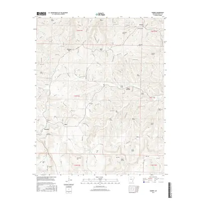
2017 Map of Harriet
USGS Topo · Published 2017About this map
Harriet and the surrounding Ozark foothills are defined by a complex network of hollows and ridges, as documented in this 2017 survey. The settlement of Morning Star sits along the northern heights, while Marshall occupies the southwestern corner near the distinctively named Devils Backbone ridge. This landscape is a patchwork of small communities and rural family landmarks, evidenced by the high concentration of burial grounds such as Cypert Cem, Red Hill Cem, and Watts Cem. Transport through these tight valleys follows the contours of Big Cr and Beaver Cr, with roads like Searcy 50 Hwy and Searcy 161 Hwy connecting the scattered hamlets. The map reveals a persistent rural settlement pattern where life centers around the water sources and high points like Stephenson Mtn and Blackjack Knob.
Find a feature on this map
131 named features on this map. Tap any name to fly to it.
Don’t see what you’re looking for? This feature index may not catch every label — zoom into the map to look around manually.
Map Details
Editions of this 2017 Harriet Map
This is the sole edition of this map. No revisions or reprints were ever made.
Other maps of this area

1890 · Mountain Home
USGS Topo · 1:125,000

1891 · Mountain Home
USGS Topo · 1:125,000

1892 · Marshall
USGS Topo · 1:125,000

1892 · Mountain View
USGS Topo · 1:125,000

1893 · Yellville
USGS Topo · 1:125,000

1894 · Mountain View
USGS Topo · 1:125,000

1894 · Mountain Home
USGS Topo · 1:125,000

1894 · Marshall
USGS Topo · 1:125,000

1901 · Marshall
USGS Topo · 1:125,000

1903 · Yellville
USGS Topo · 1:125,000