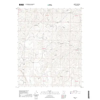
2020 Map of Harriet
USGS Topo · Published 2020About this map
Marshall and the surrounding hill country of Searcy County are defined by a network of hollows and ridges that dictated the settlement patterns of this Ozark landscape. The terrain is marked by distinctive formations like the Devils Backbone and Stephenson Mtn, with numerous family-named cemeteries such as Watts Cem, Cypert Cem, and Red Hill Cem testifying to the area's deep genealogical roots. Historically significant watercourses including Big Cr and Beaver Cr carve through the landscape, creating namesake valleys like Grassy Hollow and Hickory Hollow. Small crossroads and communities like Morning Star, Lone Pine, and Rock Springs are connected by a web of local routes like Searcy 52 Hwy and Maumee Rd, reflecting a rural character that persists into the 21st century. The map provides a detailed look at the land's transition from the residential streets of Marshall to the peaks of Blue Mtn and South Mtn.
Find a feature on this map
139 named features on this map. Tap any name to fly to it.
Don’t see what you’re looking for? This feature index may not catch every label — zoom into the map to look around manually.
Map Details
Editions of this 2020 Harriet Map
This is the sole edition of this map. No revisions or reprints were ever made.
Other maps of this area

1890 · Mountain Home
USGS Topo · 1:125,000

1891 · Mountain Home
USGS Topo · 1:125,000

1892 · Marshall
USGS Topo · 1:125,000

1892 · Mountain View
USGS Topo · 1:125,000

1893 · Yellville
USGS Topo · 1:125,000

1894 · Mountain View
USGS Topo · 1:125,000

1894 · Mountain Home
USGS Topo · 1:125,000

1894 · Marshall
USGS Topo · 1:125,000

1901 · Marshall
USGS Topo · 1:125,000

1903 · Yellville
USGS Topo · 1:125,000