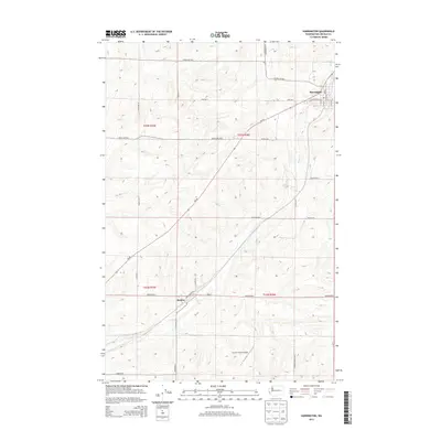
2013 Map of Harrington
USGS Topo · Published 2013About this map
Harrington serves as the primary hub in this portion of Lincoln County, where the street grid includes W Sherlock St and S 1st St. This agricultural landscape is defined by the drainage of Coal Cr as it winds through the township boundaries of t23n r36e and t22n r35e. The small community of Mohler sits southwest of the main town, positioned along Coulee Rd E and Mohler Rd E. The rural character of the area is further emphasized by the numerous named ranch and farm roads, such as Buddrius Farms Rd N and Timm Rd N, which connect isolated homesteads. Near the southern edge of the quadrangle, the Kramer Ranch Airport indicates the continued importance of private aviation for managing these expansive properties in eastern Washington.
Find a feature on this map
28 named features on this map. Tap any name to fly to it.
Don’t see what you’re looking for? This feature index may not catch every label — zoom into the map to look around manually.
Map Details
Editions of this 2013 Harrington Map
This is the sole edition of this map. No revisions or reprints were ever made.
Other maps of this area

1953 · Ritzville
USGS Topo · 1:250,000

1959 · Ritzville
USGS Topo · 1:250,000

1965 · Ritzville
USGS Topo · 1:250,000

1969 · Rocklyn SW
USGS Topo · 1:24,000

1969 · Bluestem
USGS Topo · 1:24,000

1969 · Harrington
USGS Topo · 1:24,000

1969 · Lords Valley
USGS Topo · 1:24,000

1969 · Cormana Lake
USGS Topo · 1:24,000

1969 · Lamona
USGS Topo · 1:24,000
1969 · Sprague Lake SW
USGS Topo · 1:24,000