2023 Map of Harrington
USGS Topo · Published 2023About this map
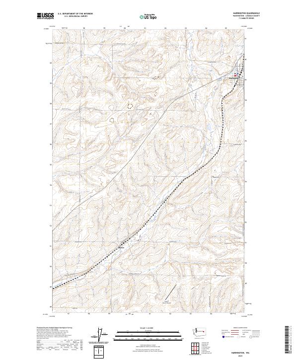
The town of Harrington anchors the northeastern corner of this Lincoln County survey, where the local road network reflects a landscape defined by expansive agriculture and the winding path of Coal Creek. This creek cuts a diagonal course through the center of the sheet, followed closely by the Coal Coulee Rd E. The rural character of the region is punctuated by family-named landmarks and essential infrastructure, such as the Kramer Ranch Airport and large agricultural operations like Kramer Farms Rd and Buddhrius Farms Rd. The grid of the Public Land Survey System is still clearly visible through the placement of routes like Duck Lake Rd E and Coffee Pot Rd E, which provide access across the high plains. In the southern half, the small community of Mohler sits along the transit corridor of the Harrington-Tokio Rd, showing the continued importance of these historical settlement nodes.
Find a feature on this map
25 named features on this map. Tap any name to fly to it.
Don’t see what you’re looking for? This feature index may not catch every label — zoom into the map to look around manually.
Map Details
Editions of this 2023 Harrington Map
This is the sole edition of this map. No revisions or reprints were ever made.