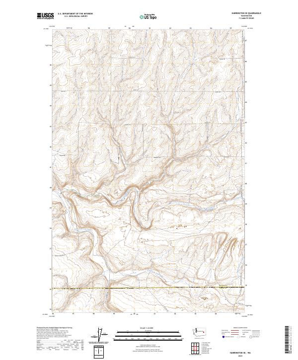
2023 Map of Harrington SE
USGS Topo · Published 2023About this map
Crab Creek and its tributary, South Fork Crab Creek, dictate the movement across this rural landscape where the border between Lincoln and Adams counties is defined by a section line rather than the winding water. The terrain is marked by the complex topography of the Channeled Scablands, where local transit is limited to a network of section-line roads and winding paths like Rocky Ford Rd N and Harrington-Tokio Rd. Named local routes such as Schuh Rd, Walters Rd N, and Zondel Rd suggest the long-standing family farm holdings that characterize this portion of Eastern Washington. The map serves as a detailed record of drainage patterns and land division in a region where water sources and elevation significantly influence the agricultural footprint and placement of homesteads.
Find a feature on this map
27 named features on this map. Tap any name to fly to it.
Don’t see what you’re looking for? This feature index may not catch every label — zoom into the map to look around manually.
Map Details
Editions of this 2023 Harrington SE Map
This is the sole edition of this map. No revisions or reprints were ever made.
Other maps of this area

1953 · Ritzville
USGS Topo · 1:250,000

1959 · Ritzville
USGS Topo · 1:250,000

1964 · Karakul Hills
USGS Topo · 1:24,000

1965 · Ritzville
USGS Topo · 1:250,000

1967 · Ritzville NE
USGS Topo · 1:24,000

1967 · Ritzville NW
USGS Topo · 1:24,000

1969 · Harrington
USGS Topo · 1:24,000

1969 · Lords Valley
USGS Topo · 1:24,000

1969 · Cormana Lake
USGS Topo · 1:24,000

1969 · Lamona
USGS Topo · 1:24,000