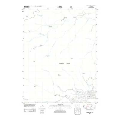
2011 Map of Harris Park
USGS Topo · Published 2011About this map
Harris Park sits at the base of the Front Range high country, where the residential grid of Elk Creek Dr and Wilkins Rd meets the drainage of Deer Creek. This 2011 survey captures the area as a hub for mountaineering and recreation, centered around the Deer Creek Trailhead and a network of high-altitude destinations including Rogers Peak and Rosalie Peak. The landscape is defined by the sharp transition from the valley floor to the prominent granite outcrops of Pegmatite Points and Royal Mountain. Higher elevations are marked by remote landmarks such as the Mount Evans Shelter House and various alpine waters like Lincoln Lake and the Beartrack Lakes. The map traces the winding paths of Bear Creek and Tumbling Creek as they descend from the Summit Lake Flats, while the residential pocket of Harris Park remains concentrated along the Church Fork Elk Creek near Camp Rosalie.
Find a feature on this map
47 named features on this map. Tap any name to fly to it.
Don’t see what you’re looking for? This feature index may not catch every label — zoom into the map to look around manually.
Map Details
Editions of this 2011 Harris Park Map
This is the sole edition of this map. No revisions or reprints were ever made.
Other maps of this area

1893 · Platte Canyon
USGS Topo · 1:125,000

1899 · West Denver
USGS Topo · 1:125,000

1903 · Georgetown
USGS Topo · 1:62,500

1905 · Georgetown
USGS Topo · 1:62,500

1945 · Bailey
USGS Topo · 1:24,000

1945 · Shawnee
USGS Topo · 1:24,000

1945 · Mount Logan
USGS Topo · 1:24,000

1948 · Mount Logan
USGS Topo · 1:24,000

1948 · Shawnee
USGS Topo · 1:24,000

1949 · Bailey
USGS Topo · 1:24,000