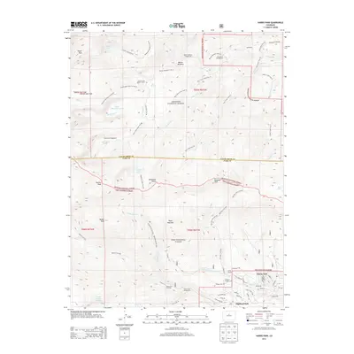
2013 Map of Harris Park
USGS Topo · Published 2013About this map
Harris Park and Highland Park anchor the lower elevations of this high-altitude landscape, where residential street networks like Miners Way and Gold Flake Tr meet the expansive wilderness of the Arapaho National Forest and Pike National Forest. The terrain is defined by extreme relief, rising from the residential clusters toward massive summits such as Rogers Peak, Rosalie Peak, and Royal Mountain. This 2013 survey shows an extensive network of recreational infrastructure, including the Mount Evans Shelter House and numerous backcountry sites like the Beartrack Campground. Drainage systems such as Bear Cr, Deer Cr, and Elk Cr carve through the mountains, supported by a dense web of established paths including the Lincoln Lake Trail 45, Beaver Meadows Trail 44, and the Meridian Trail 604. This map documents the intersection of modern mountain living and protected federal lands in the early 21st century.
Find a feature on this map
74 named features on this map. Tap any name to fly to it.
Don’t see what you’re looking for? This feature index may not catch every label — zoom into the map to look around manually.
Map Details
Editions of this 2013 Harris Park Map
This is the sole edition of this map. No revisions or reprints were ever made.
Other maps of this area

1893 · Platte Canyon
USGS Topo · 1:125,000

1899 · West Denver
USGS Topo · 1:125,000

1903 · Georgetown
USGS Topo · 1:62,500

1905 · Georgetown
USGS Topo · 1:62,500

1945 · Bailey
USGS Topo · 1:24,000

1945 · Shawnee
USGS Topo · 1:24,000

1945 · Mount Logan
USGS Topo · 1:24,000

1948 · Mount Logan
USGS Topo · 1:24,000

1948 · Shawnee
USGS Topo · 1:24,000

1949 · Bailey
USGS Topo · 1:24,000