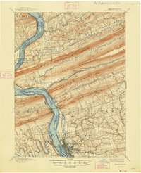
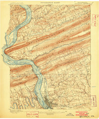
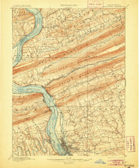
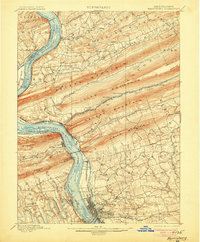
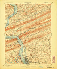
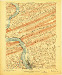
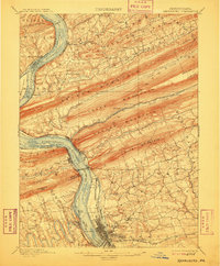
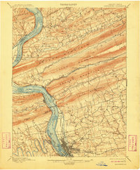
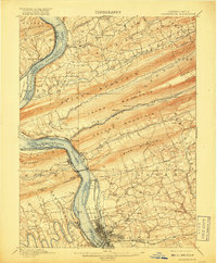
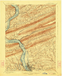
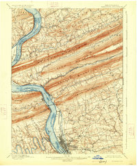
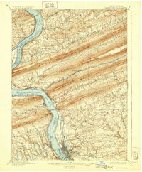
1899 Map of Harrisburg
USGS Topo · Published 1948About this map
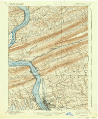
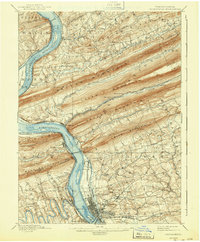
The Susquehanna River dominates this nineteenth-century landscape, acting as a corridor for major infrastructure during Pennsylvania's industrial expansion. The Pennsylvania Railroad and the Northern Central Railroad trace the riverbanks, serving busy riverfront towns like Marysville and Wormleysburg. Notable is the extensive footprint of the State Lunatic Asylum on the outskirts of Harrisburg, reflecting the era's institutional development. The map also records the location of the (Susquehanna Div.) Canal, which is noted as (Abandoned) in several sections, signaling the transition from water-borne freight to the dominance of steam rail. To the north, the geography is defined by a series of dramatic ridges including Peters Mountain and Second Mountain, which funneled settlement into narrow valleys such as Powell Valley and along Stony Creek. Smaller hamlets like Heckton Mills and Stone Glen provide a window into the rural life that existed just beyond the state capital's reach.
Find a feature on this map
86 named features on this map. Tap any name to fly to it.
Don’t see what you’re looking for? This feature index may not catch every label — zoom into the map to look around manually.
Map Details
Editions of this 1899 Harrisburg Map
15 editions found

1899 edition
16.5 x 19.9 inches
1902 edition
16.5 x 20 inches
1905 edition
16.5 x 19.9 inches
1906 edition
16.5 x 19.9 inches
1907 edition
16.5 x 19.9 inches
1908 edition
16.5 x 19.9 inches
1909 edition
16.5 x 19.9 inches
1910 edition
16.5 x 20 inches
1917 edition
16.5 x 19.9 inches
1924 edition
16.5 x 20 inches
1926 edition
16.5 x 20 inches
1929 edition
16.5 x 20 inches
1937 edition
16.5 x 20 inches
1943 edition
16.5 x 20 inches
1948 edition
17 x 21 inches
Other maps of this area

1892 · Lykens
USGS Topo · 1:62,500

1892 · Hummelstown
USGS Topo · 1:62,500

1892 · Harrisburg
USGS Topo · 1:62,500

1893 · Lykens
USGS Topo · 1:62,500

1893 · Millersburg
USGS Topo · 1:62,500
1899 · Harrisburg
USGS Topo · 1:62,500

1904 · Carlisle
USGS Topo · 1:62,500

1906 · New Cumberland
USGS Topo · 1:62,500

1907 · New Bloomfield
USGS Topo · 1:62,500

1907 · Millerstown
USGS Topo · 1:62,500
Featured Places
- Harrisburg, PA
- Colonial Park, Lower Paxton Township
- Progress, Susquehanna Township
- Linglestown, Lower Paxton Township
- Enola, East Pennsboro Township