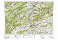
1957 Map of Harrisburg
USGS Topo · Published 1980About this map
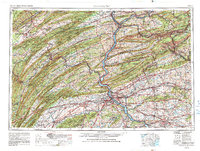
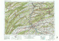
The State Capitol in Harrisburg anchors this 1969 revision, documenting a massive stretch of Central Pennsylvania defined by the dramatic ridge-and-valley landscape. The Susquehanna River serves as the central artery, joined by the Juniata River and West Branch Susquehanna River, carving through prominent terrain like Blue Mountain and Peters Mountain. This topography dictated the corridor for the Pennsylvania RR and the Pennsylvania Turnpike, connecting industrial hubs like Shamokin, Pottsville, and Lebanon.
Find a feature on this map
98 named features on this map. Tap any name to fly to it.
Don’t see what you’re looking for? This feature index may not catch every label — zoom into the map to look around manually.
Map Details
Editions of this 1957 Harrisburg Map
7 editions found

Other maps of this area

1889 · Catawissa
USGS Topo · 1:62,500

1889 · Hazleton
USGS Topo · 1:62,500

1889 · Pottsville
USGS Topo · 1:62,500

1891 · Wilkesbarre
USGS Topo · 1:62,500

1891 · Hazleton
USGS Topo · 1:62,500

1891 · Pottsville
USGS Topo · 1:62,500

1891 · Lebanon
USGS Topo · 1:62,500

1892 · Catawissa
USGS Topo · 1:62,500

1892 · Lykens
USGS Topo · 1:62,500

1892 · Hummelstown
USGS Topo · 1:62,500