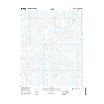
2016 Map of Harrison Bay A-2 SW
USGS Topo · Published 2016About this map
Colville River dominates the northern landscape of this North Slope region, winding through a complex network of wetlands and tundra within the t9n r4e and t9n r5e townships. This 2016 survey illustrates the dynamic hydrology of the Arctic coastal plain, where the river braids across the landscape, leaving behind numerous small thaw lakes and interconnected water bodies. Near the southern edge of the quadrangle, the Itkillik River converges toward the larger channel, highlighting a geography defined almost entirely by water and seasonal drainage patterns. The map provides a precise record of the shoreline and riverbanks as they existed during the 2009 to 2015 imagery period, offering an essential benchmark for researchers monitoring shifts in Arctic river systems.
Find a feature on this map
6 named features on this map. Tap any name to fly to it.
Don’t see what you’re looking for? This feature index may not catch every label — zoom into the map to look around manually.
Map Details
Editions of this 2016 Harrison Bay A-2 SW Map
This is the sole edition of this map. No revisions or reprints were ever made.
Other maps of this area

1951 · Harrison Bay
USGS Topo · 1:250,000

1952 · Umiat
USGS Topo · 1:250,000

1955 · Harrison Bay
USGS Topo · 1:250,000

1955 · Umiat D-2
USGS Topo · 1:63,360

1955 · Harrison Bay A-2
USGS Topo · 1:63,360

1955 · Harrison Bay A-3
USGS Topo · 1:63,360

1955 · Umiat D-3
USGS Topo · 1:63,360

1956 · Umiat
USGS Topo · 1:250,000

1964 · Umiat
USGS Topo · 1:250,000
2013 · Umiat D-3 NE
USGS Topo · 1:25,000