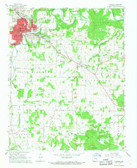
1967 Map of Harrison
USGS Topo · Published 1968About this map
Harrison serves as the regional hub of Boone County in the late 1960s, its urban grid tightly packed between the winding path of Crooked Creek and Maplewood Cem. The city’s mid-century expansion is evidenced by several educational landmarks, including Skyline Heights Sch and Forest Heights Sch, alongside the County Hospital and the central Courthouse.
Find a feature on this map
54 named features on this map. Tap any name to fly to it.
Don’t see what you’re looking for? This feature index may not catch every label — zoom into the map to look around manually.
Map Details
Editions of this 1967 Harrison Map
2 editions found
Other maps of this area

1893 · Yellville
USGS Topo · 1:125,000

1903 · Yellville
USGS Topo · 1:125,000

1904 · Harrison
USGS Topo · 1:125,000

1905 · Harrison
USGS Topo · 1:125,000

1905 · Yellville
USGS Topo · 1:125,000

1929 · Yellville
USGS Topo · 1:125,000

1945 · Harrison
USGS Topo · 1:250,000

1949 · Harrison
USGS Topo · 1:250,000

1954 · Harrison
USGS Topo · 1:250,000

1958 · Harrison
USGS Topo · 1:250,000