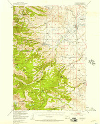
1950 Map of Harrison
USGS Topo · Published 1956About this map
Harrison and Pony serve as the primary hubs in this Madison County landscape, where the agricultural plains of the Antelope area meet the mining-rich slopes of the Bacco Root Mountains. The 1950 field check reveals an economy deeply rooted in both extraction and land management, evidenced by the cluster of workings like the Garnet Gold Mine and the Atlantic and Pacific Mine near the Deerlodge National Forest boundary. The presence of the Indiana University Geology Field Sta highlights the region's importance for scientific study, while the Northern Pacific railroad provides the essential link for the local Harrison Mill. Higher elevations are punctuated by numerous alpine waters, including Hollow Top Lake and Branham Lakes, alongside the Potosi Ranger Station and the nearby Potosi Hot Springs. This period captures the Missouri River Basin development era, as noted in the margin, reflecting a landscape of active placer mining and established ranching operations like the Springside Ranch.
Find a feature on this map
88 named features on this map. Tap any name to fly to it.
Don’t see what you’re looking for? This feature index may not catch every label — zoom into the map to look around manually.
Map Details
Editions of this 1950 Harrison Map
5 editions found

Other maps of this area

1888 · Three Forks
USGS Topo · 1:250,000

1893 · Dillon
USGS Topo · 1:250,000

1894 · Three Forks
USGS Topo · 1:250,000

1895 · Three Forks
USGS Topo · 1:250,000

1947 · Bozeman
USGS Topo · 1:250,000

1948 · Bozeman
USGS Topo · 1:250,000

1949 · Ennis
USGS Topo · 1:62,500

1949 · Norris
USGS Topo · 1:62,500

1950 · Three Forks
USGS Topo · 1:62,500

1950 · Jefferson Island
USGS Topo · 1:62,500