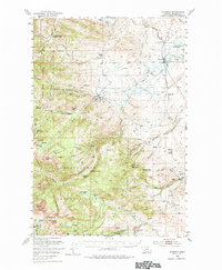
1950 Map of Harrison
USGS Topo · Published 1984About this map
Harrison stands as a rail-connected hub in the northeastern corner of this 1950s survey, where the Northern Pacific line tracks past the Harrison Mill and Harrison Cem. The landscape to the west rises sharply into the Beaverhead Mountains and the Deerlodge National Forest, revealing a dense history of extraction and mountain habitation. Small settlements like Pony and Sterling are flanked by numerous mining claims, including the Boss Tweed Mine, Atlantic and Pacific Mine, and the Revenue Mine to the south.
Find a feature on this map
87 named features on this map. Tap any name to fly to it.
Don’t see what you’re looking for? This feature index may not catch every label — zoom into the map to look around manually.
Map Details
Editions of this 1950 Harrison Map
5 editions found

Other maps of this area

1888 · Three Forks
USGS Topo · 1:250,000

1893 · Dillon
USGS Topo · 1:250,000

1894 · Three Forks
USGS Topo · 1:250,000

1895 · Three Forks
USGS Topo · 1:250,000

1947 · Bozeman
USGS Topo · 1:250,000

1948 · Bozeman
USGS Topo · 1:250,000

1949 · Ennis
USGS Topo · 1:62,500

1949 · Norris
USGS Topo · 1:62,500

1950 · Three Forks
USGS Topo · 1:62,500

1950 · Jefferson Island
USGS Topo · 1:62,500