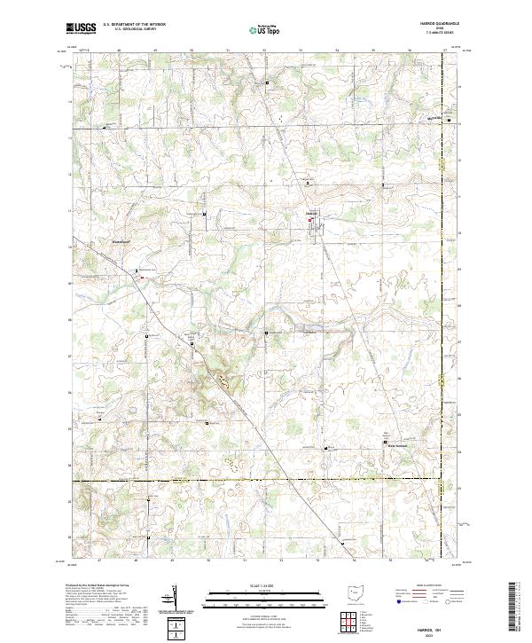
2023 Map of Harrod
USGS Topo · Published 2023About this map
The Auglaize River meanders through this agricultural section of Allen County, anchoring a landscape defined by small crossroads settlements and numerous family and community burial grounds. Harrod serves as a central hub, flanked by the villages of Westminster and West Newton. The map provides a detailed view of the rural cemetery network essential for genealogical research, including the Hullibarger Cem, Westminster Salem Cem, and Mount Zion Cem. Drainage patterns are dictated by several waterways such as Little Hog Creek, Muchinippi Creek, and the Beaver Dam Branch, which cut through the varied township sections. This 2023 edition documents the modern road grid, from High Street Rd to the southern reaches near Mars Hill Cem, preserving the spatial relationship between these historic townships and their ancestral landmarks.
Find a feature on this map
100 named features on this map. Tap any name to fly to it.
Don’t see what you’re looking for? This feature index may not catch every label — zoom into the map to look around manually.
Map Details
Editions of this 2023 Harrod Map
This is the sole edition of this map. No revisions or reprints were ever made.
Other maps of this area

1906 · Lima
USGS Topo · 1:62,500

1906 · Columbus Grove
USGS Topo · 1:62,500

1907 · Bluffton
USGS Topo · 1:62,500

1908 · Columbus Grove
USGS Topo · 1:62,500

1913 · Alger
USGS Topo · 1:48,000

1915 · Alger
USGS Topo · 1:62,500

1943 · Alger
USGS Topo · 1:62,500

1950 · Marion
USGS Topo · 1:250,000

1953 · Muncie
USGS Topo · 1:250,000

1956 · Muncie
USGS Topo · 1:250,000