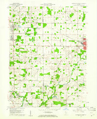
1960 Map of Hartford City West
USGS Topo · Published 1982About this map
Taylor University and the Purdue University Memorial Farm anchor this agricultural landscape during the 1960s, where the rural communities of Upland and Matthews sit at the intersection of rail lines and waterways. The Mississinewa River winds through the southern reaches, featuring a notable Covered Bridge near the Matthews town site. This survey highlights the institutional character of the era, from the County Infirmary to local rural schools like Parkside Sch and Township Sch.
Find a feature on this map
47 named features on this map. Tap any name to fly to it.
Don’t see what you’re looking for? This feature index may not catch every label — zoom into the map to look around manually.
Map Details
Editions of this 1960 Hartford City West Map
5 editions found
Other maps of this area

1953 · Muncie
USGS Topo · 1:250,000

1956 · Muncie
USGS Topo · 1:250,000

1960 · Hartford City East
USGS Topo · 1:24,000

1960 · Eaton
USGS Topo · 1:24,000

1960 · Wheeling
USGS Topo · 1:24,000

1960 · Gas City
USGS Topo · 1:24,000

1960 · Gaston
USGS Topo · 1:24,000

1960 · Hartford City West
USGS Topo · 1:24,000

1962 · Montpelier
USGS Topo · 1:24,000

1962 · Roll
USGS Topo · 1:24,000