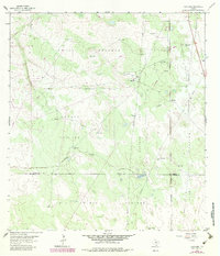
1963 Map of Hartland
USGS Topo · Published 1983About this map
Patitos Pasture and several other large-scale grazing divisions define the landscape along the Brooks and Hidalgo County line. This 1963 survey, with revisions from 1980, reveals a pastoral economy heavily dependent on scattered water infrastructure. A dense network of named windmills, such as Los Aceiteros Windmill and Buena Suerte Windmill, provides essential water for livestock across the vast, open terrain.
Find a feature on this map
43 named features on this map. Tap any name to fly to it.
Don’t see what you’re looking for? This feature index may not catch every label — zoom into the map to look around manually.
Map Details
Editions of this 1963 Hartland Map
2 editions found
Other maps of this area

1939 · Linn
USGS Topo · 1:62,500

1939 · La Reforma
USGS Topo · 1:62,500

1939 · Encantada
USGS Topo · 1:62,500

1949 · Mc Allen
USGS Topo · 1:250,000

1954 · McAllen
USGS Topo · 1:250,000

1957 · Mc Allen
USGS Topo · 1:250,000

1962 · McAllen
USGS Topo · 1:250,000
1963 · Callo Padrones
USGS Topo · 1:24,000
1963 · Encino
USGS Topo · 1:24,000

1963 · Linn NW
USGS Topo · 1:24,000