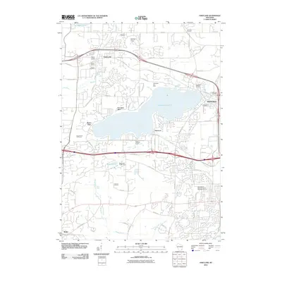
2010 Map of Hartland
USGS Topo · Published 2010About this map
Pewaukee Lake dominates this 2010 landscape, acting as a central hub for the established communities of Hartland and Pewaukee. The map reveals a suburban-rural blend, where sprawling residential developments like Edgewood and Pewaukee West sit alongside expansive green spaces, including the Naga-Waukee Golf Course and Bristlecone Pines Golf Course. The University of Wisconsin Center highlights the area's role as an educational and institutional anchor for the region.
Find a feature on this map
74 named features on this map. Tap any name to fly to it.
Don’t see what you’re looking for? This feature index may not catch every label — zoom into the map to look around manually.
Map Details
Editions of this 2010 Hartland Map
This is the sole edition of this map. No revisions or reprints were ever made.
Other maps of this area

1891 · Muskego
USGS Topo · 1:62,500

1892 · Waukesha
USGS Topo · 1:62,500

1892 · Oconomowoc
USGS Topo · 1:62,500

1892 · Eagle
USGS Topo · 1:62,500

1894 · Eagle
USGS Topo · 1:62,500

1897 · Eagle
USGS Topo · 1:62,500

1901 · Waukesha
USGS Topo · 1:62,500

1901 · Muskego
USGS Topo · 1:62,500

1906 · Eagle
USGS Topo · 1:62,500

1906 · Waukesha
USGS Topo · 1:62,500