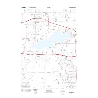
2013 Map of Hartland
USGS Topo · Published 2013About this map
Hartland and its surrounding suburban enclaves anchor this 2013 landscape, where the glacial geography of Waukesha County is defined by prominent water bodies and recreation areas. The massive Pewaukee Lake dominates the central portion of the map, flanked by residential developments like Pewaukee West, Buena Vista, and Edgewood. The Bark River and Pewaukee River create a complex hydrological network that connects smaller basins, including Salow Lake 1 and Etter Lake.
Find a feature on this map
206 named features on this map. Tap any name to fly to it.
Don’t see what you’re looking for? This feature index may not catch every label — zoom into the map to look around manually.
Map Details
Editions of this 2013 Hartland Map
This is the sole edition of this map. No revisions or reprints were ever made.
Other maps of this area

1891 · Muskego
USGS Topo · 1:62,500

1892 · Waukesha
USGS Topo · 1:62,500

1892 · Oconomowoc
USGS Topo · 1:62,500

1892 · Eagle
USGS Topo · 1:62,500

1894 · Eagle
USGS Topo · 1:62,500

1897 · Eagle
USGS Topo · 1:62,500

1901 · Waukesha
USGS Topo · 1:62,500

1901 · Muskego
USGS Topo · 1:62,500

1906 · Eagle
USGS Topo · 1:62,500

1906 · Waukesha
USGS Topo · 1:62,500