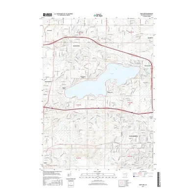
2015 Map of Hartland
USGS Topo · Published 2015About this map
Pewaukee Lake dominates the central landscape of this Waukesha County region, surrounded by residential clusters such as Pewaukee West, Buena Vista, and Edgewood. The Bark River flows through Hartland in the north, where local history is anchored by Hartland Lutheran Cem and Highland Cem. This survey illustrates the dense suburban and recreational development patterns of the early 21st century, showing the proximity of the Waukesha County Airport and the Waukesha County Technical College to the expanding city of Waukesha. For those interested in the natural history of Wisconsin, the Ice Age National Scenic Trail winds through the northwestern corner near Chenequa. The map also identifies numerous family-history landmarks, including the Tabernacle Cemetery and Richmond Cemetery, providing a detailed look at the local burial grounds that remain preserved amidst modern road networks like County Road DR and the Summit Avenue corridor.
Find a feature on this map
111 named features on this map. Tap any name to fly to it.
Don’t see what you’re looking for? This feature index may not catch every label — zoom into the map to look around manually.
Map Details
Editions of this 2015 Hartland Map
This is the sole edition of this map. No revisions or reprints were ever made.
Other maps of this area

1891 · Muskego
USGS Topo · 1:62,500

1892 · Waukesha
USGS Topo · 1:62,500

1892 · Oconomowoc
USGS Topo · 1:62,500

1892 · Eagle
USGS Topo · 1:62,500

1894 · Eagle
USGS Topo · 1:62,500

1897 · Eagle
USGS Topo · 1:62,500

1901 · Waukesha
USGS Topo · 1:62,500

1901 · Muskego
USGS Topo · 1:62,500

1906 · Eagle
USGS Topo · 1:62,500

1906 · Waukesha
USGS Topo · 1:62,500