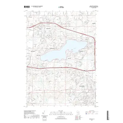
2018 Map of Hartland
USGS Topo · Published 2018About this map
The sprawling waters of Pewaukee Lake dominate the central landscape of this Waukesha County region, where the urban boundaries of Waukesha and Pewaukee meet established residential enclaves. This 2018 survey documents a complex network of suburban development intertwined with glacial water bodies, including the Bark River and Pebble Creek. Local history is anchored by several burial grounds, such as the Richmond Cemetery to the north and the Tabernacle Cemetery near Etter Lake. The map reveals the distinct identities of surrounding villages like Hartland, Delafield, and Wales, showing how they have evolved from early settlements into integrated parts of the metropolitan corridor. For the researcher, the map provides precise locations for family-named landmarks and historical sites like Saint Marys Catholic Cemetery and the two distinct sections of the Village of Hartland Cemetery.
Find a feature on this map
291 named features on this map. Tap any name to fly to it.
Don’t see what you’re looking for? This feature index may not catch every label — zoom into the map to look around manually.
Map Details
Editions of this 2018 Hartland Map
This is the sole edition of this map. No revisions or reprints were ever made.
Other maps of this area

1891 · Muskego
USGS Topo · 1:62,500

1892 · Waukesha
USGS Topo · 1:62,500

1892 · Oconomowoc
USGS Topo · 1:62,500

1892 · Eagle
USGS Topo · 1:62,500

1894 · Eagle
USGS Topo · 1:62,500

1897 · Eagle
USGS Topo · 1:62,500

1901 · Waukesha
USGS Topo · 1:62,500

1901 · Muskego
USGS Topo · 1:62,500

1906 · Eagle
USGS Topo · 1:62,500

1906 · Waukesha
USGS Topo · 1:62,500