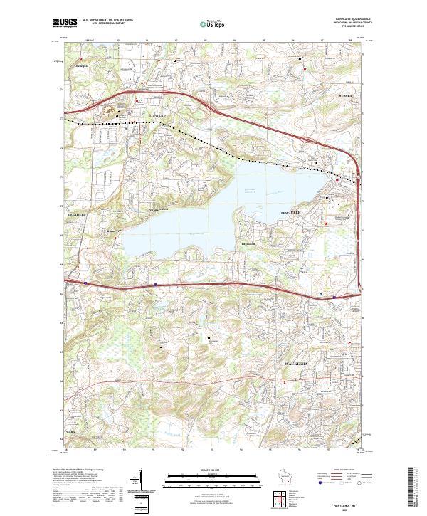
2022 Map of Hartland
USGS Topo · Published 2022About this map
Pewaukee Lake serves as the central focal point of this Waukesha County landscape, surrounded by the developed residential and suburban hubs of Hartland, Pewaukee, and Delafield. The map documents a densely populated region where municipal growth has integrated with historical landmarks. Genealogists will find several burial grounds of interest, including the Village of Hartland Cem North and South, as well as the Saint Marys Cem near Sussex. The southern portion of the map transitions toward the urban edge of Waukesha, featuring significant infrastructure such as the Waukesha County Airport and the Waukesha County Technical College. Waterways like the Bark River and Pewaukee River navigate the terrain between these established settlements, illustrating the suburban evolution of the area as it appeared in the early 2020s.
Find a feature on this map
99 named features on this map. Tap any name to fly to it.
Don’t see what you’re looking for? This feature index may not catch every label — zoom into the map to look around manually.
Map Details
Editions of this 2022 Hartland Map
This is the sole edition of this map. No revisions or reprints were ever made.
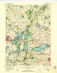
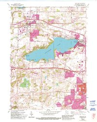
Historical Maps of Waukesha Through Time
3 maps found