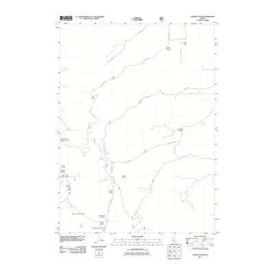
2011 Map of Hartley Peak
USGS Topo · Published 2011About this map
Hartley Peak dominates this portion of Power County, where the high desert landscape is etched by a complex network of canyons and drainage systems. The map details a rugged interior accessible primarily via primitive routes like Cliff Canyon Rd and Green Canyon Rd. Notable for its descriptive toponyms, the area includes deep incisions such as Red Ledge Canyon and Warner Canyon, suggesting a history of local geographic identification based on visible geology and flora. The drainage of North Fork Sublett Creek provides a primary hydrological axis in the south, while names like Sawpit Canyon and Last Chance Gulch hint at the area's resource-extraction heritage, where early settlers or prospectors named the land after their labors and narrow margins of success. The isolation of features like Cedar Ridge underscores the traditional ranching and backcountry character of this Idaho terrain.
Find a feature on this map
36 named features on this map. Tap any name to fly to it.
Don’t see what you’re looking for? This feature index may not catch every label — zoom into the map to look around manually.
Map Details
Editions of this 2011 Hartley Peak Map
This is the sole edition of this map. No revisions or reprints were ever made.
Other maps of this area

1934 · Rockland
USGS Topo · 1:62,500

1937 · Rockland
USGS Topo · 1:62,500

1954 · Pocatello
USGS Topo · 1:250,000

1958 · Pocatello
USGS Topo · 1:250,000

1958 · Sublett
USGS Topo · 1:62,500

1959 · Yale
USGS Topo · 1:62,500

1971 · Rockland East
USGS Topo · 1:24,000

1971 · Rockland West
USGS Topo · 1:24,000

1973 · Hartley Peak
USGS Topo · 1:24,000

1973 · Sublett Troughs
USGS Topo · 1:24,000