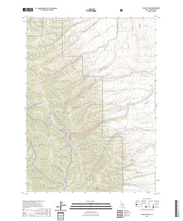
2023 Map of Hartley Peak
USGS Topo · Published 2023About this map
Hartley Peak stands as the central landmark of this high-elevation terrain within the Sublett Range, where the steep drainages of the Sawtooth National Forest dominate the landscape. The geography is defined by a dense network of canyons, including Red Ledge Canyon, Mistletoe Canyon, and the appropriately named Windy Canyon. These corridors have historically dictated movement through the mountains, evidenced by modern access routes like Hartley Canyon Rd and rugged paths such as the Sheep Canyon Trl. To the north, Cedar Ridge overlooks the junction of Warner Canyon and Flint Canyon, while the southern reaches are marked by Last Chance Gulch and the headwaters of North Fork Sublett Creek. This survey illustrates how the ridge-and-canyon system continues to shape land use and forestry boundaries in this part of Power County.
Find a feature on this map
43 named features on this map. Tap any name to fly to it.
Don’t see what you’re looking for? This feature index may not catch every label — zoom into the map to look around manually.
Map Details
Editions of this 2023 Hartley Peak Map
This is the sole edition of this map. No revisions or reprints were ever made.
Other maps of this area

1934 · Rockland
USGS Topo · 1:62,500

1937 · Rockland
USGS Topo · 1:62,500

1954 · Pocatello
USGS Topo · 1:250,000

1958 · Pocatello
USGS Topo · 1:250,000

1958 · Sublett
USGS Topo · 1:62,500

1959 · Yale
USGS Topo · 1:62,500

1971 · Rockland East
USGS Topo · 1:24,000

1971 · Rockland West
USGS Topo · 1:24,000

1973 · Hartley Peak
USGS Topo · 1:24,000

1973 · Sublett Troughs
USGS Topo · 1:24,000