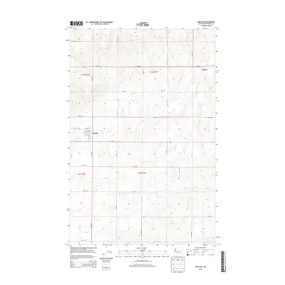
2014 Map of Hartline
USGS Topo · Published 2014About this map
The town of Hartline serves as a focal point in this eastern Washington landscape, situated along the major corridor of Us-2. The local street grid is clearly defined, featuring residential thoroughfares such as Kelley St, Lenard St, and Chelan St. To the northeast, the smaller settlement of Hanson is identified alongside a network of rural section-line roads including 44-NE Rd and Road V NE. This 2014 survey illustrates a highly organized agricultural layout, where the Public Land Survey System has dictated the placement of nearly all infrastructure. A notable local landmark for genealogists and researchers is the Welsh Cem, located north of the main town center between Road T NE and Road U NE.
Find a feature on this map
29 named features on this map. Tap any name to fly to it.
Don’t see what you’re looking for? This feature index may not catch every label — zoom into the map to look around manually.
Map Details
Editions of this 2014 Hartline Map
This is the sole edition of this map. No revisions or reprints were ever made.
Other maps of this area

1948 · Grand Coulee Dam
USGS Topo · 1:62,500

1950 · Grand Coulee Dam
USGS Topo · 1:62,500

1953 · Ritzville
USGS Topo · 1:250,000

1959 · Ritzville
USGS Topo · 1:250,000

1965 · Ritzville
USGS Topo · 1:250,000

1968 · Steamboat Rock SW
USGS Topo · 1:24,000

1968 · Hartline
USGS Topo · 1:24,000

1968 · Hartline SW
USGS Topo · 1:24,000

1968 · Steamboat Rock SE
USGS Topo · 1:24,000

1968 · Hartline SE
USGS Topo · 1:24,000