
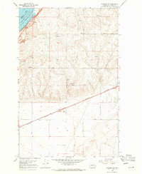
1968 Map of Hartline SE
USGS Topo · Published 1971About this map
Wilson Creek carves through the southeastern corner of this Grant County landscape, illustrating the agricultural and hydraulic character of the region in the late 1960s. The terrain is defined by a strictly organized grid of rural arteries, such as Road 33 NE and Road 30 NE, which provided essential access to remote acreage. Scattered infrastructure points to the working life of the land, including a Storage Bin and multiple water sources like Well 1741 and several isolated Springs. The presence of a Gravel Pit and numerous Jeep Trails suggests a landscape utilized for both local resource extraction and rugged transport. This survey offers a precise look at the transition from high plateau farming down toward the coulee systems common in this part of Washington.
Find a feature on this map
26 named features on this map. Tap any name to fly to it.
Don’t see what you’re looking for? This feature index may not catch every label — zoom into the map to look around manually.
Map Details
Editions of this 1968 Hartline SE Map
This is the sole edition of this map. No revisions or reprints were ever made.
Other maps of this area

1953 · Ritzville
USGS Topo · 1:250,000

1956 · Wilson Creek NW
USGS Topo · 1:24,000

1956 · Wilson Creek
USGS Topo · 1:62,500

1959 · Ritzville
USGS Topo · 1:250,000

1965 · Ritzville
USGS Topo · 1:250,000

1968 · Hartline
USGS Topo · 1:24,000

1968 · Hartline SW
USGS Topo · 1:24,000

1968 · Marlin
USGS Topo · 1:24,000
1968 · Hartline NW
USGS Topo · 1:24,000

1969 · Almira
USGS Topo · 1:24,000