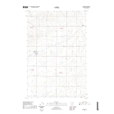
2020 Map of Hartline
USGS Topo · Published 2020About this map
Hartline stands as the primary hub of activity in this section of Grant County, defined by a distinct grid of streets including Kelley St, Willard St, and Lenard St. The surrounding high desert landscape is etched with a precise network of section-line roads, such as Rd 44 NE and Rd T NE, which support the region's agricultural character. To the northeast, the small settlement of Hanson sits along the northern edge of the map, while the Welsh Cem provides a quiet landmark for genealogists and local historians tracking early families in the area. The map illustrates the structured township and range system common to the Pacific Northwest, with the intersection of t26n r29e and t26n r30e framing the northern reaches of this rural territory.
Find a feature on this map
27 named features on this map. Tap any name to fly to it.
Don’t see what you’re looking for? This feature index may not catch every label — zoom into the map to look around manually.
Map Details
Editions of this 2020 Hartline Map
This is the sole edition of this map. No revisions or reprints were ever made.
Other maps of this area

1948 · Grand Coulee Dam
USGS Topo · 1:62,500

1950 · Grand Coulee Dam
USGS Topo · 1:62,500

1953 · Ritzville
USGS Topo · 1:250,000

1959 · Ritzville
USGS Topo · 1:250,000

1965 · Ritzville
USGS Topo · 1:250,000

1968 · Steamboat Rock SW
USGS Topo · 1:24,000

1968 · Hartline
USGS Topo · 1:24,000

1968 · Hartline SW
USGS Topo · 1:24,000

1968 · Steamboat Rock SE
USGS Topo · 1:24,000

1968 · Hartline SE
USGS Topo · 1:24,000