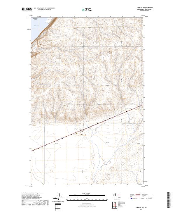
2023 Map of Hartline NW
USGS Topo · Published 2023About this map
Banks Lake defines the northwestern corner of this landscape, its shoreline bordering the rising terrain of the Grand Coulee region. The interior is characterized by the complex topography of Chase Draw, a significant drainage feature that cuts through the high plateau. A structured grid of rural infrastructure, including Rd 39 Ne and Rd 42 Ne, overlays the land, reflecting the methodical sectioning of the Big Bend country. The presence of Coulee Blvd near the lake's edge highlights the primary transit corridor through this portion of Grant County, where the dry landscape meets the vast water storage of the Columbia Basin Project. This 2023 survey illustrates the modern configuration of range lines and township boundaries, such as t26n r29e, across a terrain historically shaped by ice-age floods.
Find a feature on this map
19 named features on this map. Tap any name to fly to it.
Don’t see what you’re looking for? This feature index may not catch every label — zoom into the map to look around manually.
Map Details
Editions of this 2023 Hartline NW Map
This is the sole edition of this map. No revisions or reprints were ever made.
Other maps of this area

1930 · Grand Coulee Sheet 3
USGS Topo · 1:31,680

1953 · Ritzville
USGS Topo · 1:250,000

1959 · Ritzville
USGS Topo · 1:250,000

1965 · Ritzville
USGS Topo · 1:250,000

1965 · Mold
USGS Topo · 1:24,000

1965 · Coulee City
USGS Topo · 1:24,000

1968 · Steamboat Rock SW
USGS Topo · 1:24,000

1968 · Hartline
USGS Topo · 1:24,000

1968 · Hartline SW
USGS Topo · 1:24,000

1968 · Steamboat Rock SE
USGS Topo · 1:24,000