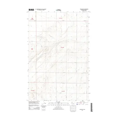
2014 Map of Hartline SW
USGS Topo · Published 2014About this map
Coulee City Airport anchors the northwest corner of this agricultural landscape in Grant County, marking the transition from aviation to the vast grid of the Columbia Basin. The terrain is defined by a series of distinct coulées and depressions, most notably Garland Lake, which sits within a complex system of contour-defined draws and ridges. A rigid township and range system dictates the movement through the area, with routes like Road L NE and Road 36 NE following section lines across the high desert plateau. The survey illustrates how late 20th and early 21st-century infrastructure relies on these established cardinal boundaries, with local connectors such as N-Ne RD and Road 31 NE providing access to the interior rangeland and scattered water features typical of this part of Eastern Washington.
Find a feature on this map
21 named features on this map. Tap any name to fly to it.
Don’t see what you’re looking for? This feature index may not catch every label — zoom into the map to look around manually.
Map Details
Editions of this 2014 Hartline SW Map
This is the sole edition of this map. No revisions or reprints were ever made.
Other maps of this area

1930 · Grand Coulee Sheet 3
USGS Topo · 1:31,680

1953 · Ritzville
USGS Topo · 1:250,000

1956 · Stratford
USGS Topo · 1:24,000

1956 · Wilson Creek NW
USGS Topo · 1:24,000

1956 · Wilson Creek
USGS Topo · 1:62,500

1959 · Ritzville
USGS Topo · 1:250,000

1965 · Ritzville
USGS Topo · 1:250,000

1965 · Mold
USGS Topo · 1:24,000

1965 · Coulee City
USGS Topo · 1:24,000

1968 · Hartline
USGS Topo · 1:24,000