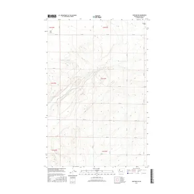
2017 Map of Hartline SW
USGS Topo · Published 2017About this map
Garland Lake sits at the heart of this high-desert landscape in Grant County, Washington, where the terrain is defined by the unique Coulee formations of the Columbia Plateau. The land is carved by natural features such as Arbuckle Draw in the northeast corner, reflecting the erosive forces that shaped this region. A strictly organized grid of rural corridors, including Rd 36 Ne and Rd 30 Ne, segments the landscape for agricultural use, connecting isolated farmsteads across the township lines. Aviation infrastructure is represented by the Coulee City Airport, which occupies a flat bench of land in the northwest. This 2017 survey illustrates the modern intersection of heavy topographic relief and the precise, human-imposed geometry of the Public Land Survey System, which remains the primary framework for land ownership and navigation in this part of eastern Washington.
Find a feature on this map
16 named features on this map. Tap any name to fly to it.
Don’t see what you’re looking for? This feature index may not catch every label — zoom into the map to look around manually.
Map Details
Editions of this 2017 Hartline SW Map
This is the sole edition of this map. No revisions or reprints were ever made.
Other maps of this area

1930 · Grand Coulee Sheet 3
USGS Topo · 1:31,680

1953 · Ritzville
USGS Topo · 1:250,000

1956 · Stratford
USGS Topo · 1:24,000

1956 · Wilson Creek NW
USGS Topo · 1:24,000

1956 · Wilson Creek
USGS Topo · 1:62,500

1959 · Ritzville
USGS Topo · 1:250,000

1965 · Ritzville
USGS Topo · 1:250,000

1965 · Mold
USGS Topo · 1:24,000

1965 · Coulee City
USGS Topo · 1:24,000

1968 · Hartline
USGS Topo · 1:24,000