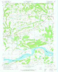
1961 Map of Hartman
USGS Topo · Published 1973About this map
Hartman serves as the focal point for this 1961 field-checked landscape, where the Missouri Pacific railroad cuts through the center of Johnson County. The area is defined by a transition from industrial activity to riverfront terrain, with numerous Strip Mines and Gas Wells scattered across the northern uplands. These resource-extraction sites sit alongside established community landmarks such as Sacred Heart, Hays Chapel, and the Union Grove Ch.
Find a feature on this map
38 named features on this map. Tap any name to fly to it.
Don’t see what you’re looking for? This feature index may not catch every label — zoom into the map to look around manually.
Map Details
Editions of this 1961 Hartman Map
3 editions found
Other maps of this area

1887 · Magazine Mountain #1
USGS Topo · 1:62,500

1887 · Magazine Mountain
USGS Topo · 1:62,500

1888 · Dardanelle #2
USGS Topo · 1:62,500

1889 · Ozone
USGS Topo · 1:62,500

1890 · Magazine Mountain
USGS Topo · 1:125,000

1890 · Dardanelle
USGS Topo · 1:125,000

1906 · Batson
USGS Topo · 1:62,500

1934 · Ozone
USGS Topo · 1:62,500

1936 · Ozone
USGS Topo · 1:62,500

1956 · Russellville
USGS Topo · 1:250,000