Loading...
Loading map...1935 Map of Harviell
USGS Topo · Published 1954About this map
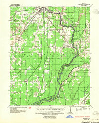
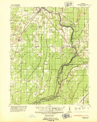
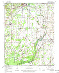
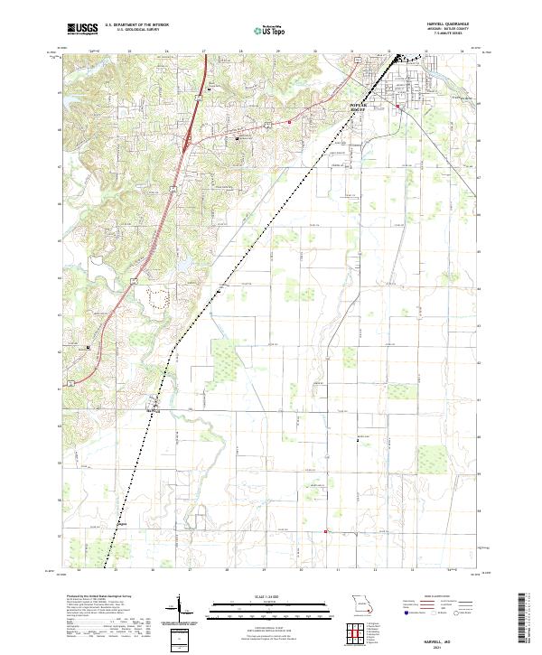
Harviell and Qulin anchor this survey of the lowlands and ridges along the Black River in southeastern Missouri. The landscape is defined by its complex hydrology, where the river winds through numerous named bends such as Shot Gun Bend and Caliph Pearl Bend, bordered by extensive sloughs like Little Hunting Slough and Swan Pond Slough. The St Louis San Francisco Railroad cuts a straight path through the territory, linking the timber and agricultural lands to the broader region.
Find a feature on this map
72 named features on this map. Tap any name to fly to it.
Don’t see what you’re looking for? This feature index may not catch every label — zoom into the map to look around manually.
Map Details
Date Portrayed1935
Date Published1954
PublisherU.S. Geological Survey
Map TypeTopographic
Scale1:62,500
Physical Dimensions17.6 x 21.9 inches
Editions of this 1935 Harviell Map
2 editions found
Historical Maps of Poplar Bluff Through Time
7 maps found
Featured Locations
Source Details
SourceU.S. Geological Survey
CopyrightPublic Domain