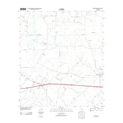
2013 Map of Harwood
USGS Topo · Published 2013About this map
Soda Springs and McNeil anchor the northern reaches of this Caldwell County landscape, where the terrain is defined by a dense network of creek drainages including Plum Cr and McNeil Cr. The southern portion of the area is dominated by the community of Harwood and the winding course of the San Marcos River. Economic activity is visible in the northwest corner at the Salt Flat Oil Field, indicating the region's historic ties to petroleum extraction. This 2013 survey provides a detailed view of the rural road network and several small burial grounds like Ebbon Cem and Plum Creek Cem, which are vital for genealogical research. The presence of Iron Peak and the Iron Mountains suggests the subtle yet varied topography of this Texas corridor, which also includes aviation history at Gottwald Field Airport.
Find a feature on this map
64 named features on this map. Tap any name to fly to it.
Don’t see what you’re looking for? This feature index may not catch every label — zoom into the map to look around manually.
Map Details
Editions of this 2013 Harwood Map
This is the sole edition of this map. No revisions or reprints were ever made.
Other maps of this area

1901 · Flatonia
USGS Topo · 1:125,000

1911 · San Marcos
USGS Topo · 1:125,000

1919 · San Marcos
USGS Topo · 1:125,000

1925 · San Marcos 4-c
USGS Topo · 1:48,000

1925 · San Marcos 1-d
USGS Topo · 1:48,000

1925 · San Marcos 4-a
USGS Topo · 1:48,000

1929 · Luling
USGS Topo · 1:62,500

1930 · Lockhart
USGS Topo · 1:62,500

1953 · Seguin
USGS Topo · 1:250,000

1958 · Seguin
USGS Topo · 1:250,000