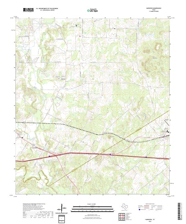
2022 Map of Harwood
USGS Topo · Published 2022About this map
The San Marcos River flows through the southwest corner of this landscape along the Caldwell and Gonzales county line, anchoring a region defined by scattered settlements and ancestral burial grounds. To the east, the community of Harwood is notable for its cluster of distinct cemeteries, including the Harwood Masonic Cem, Harwood Cem, and the Harwood Negro Cem, providing a clear record of the area's social and fraternal history. The terrain transitions from the river lowlands to the Iron Mountains and Iron Peak in the central and eastern sections.
Find a feature on this map
76 named features on this map. Tap any name to fly to it.
Don’t see what you’re looking for? This feature index may not catch every label — zoom into the map to look around manually.
Map Details
Editions of this 2022 Harwood Map
This is the sole edition of this map. No revisions or reprints were ever made.
Other maps of this area

1901 · Flatonia
USGS Topo · 1:125,000

1911 · San Marcos
USGS Topo · 1:125,000

1919 · San Marcos
USGS Topo · 1:125,000

1925 · San Marcos 4-c
USGS Topo · 1:48,000

1925 · San Marcos 1-d
USGS Topo · 1:48,000

1925 · San Marcos 4-a
USGS Topo · 1:48,000

1929 · Luling
USGS Topo · 1:62,500

1930 · Lockhart
USGS Topo · 1:62,500

1953 · Seguin
USGS Topo · 1:250,000

1958 · Seguin
USGS Topo · 1:250,000