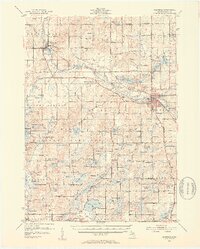
1951 Map of Hastings
USGS Topo · Published 1953About this map
Hastings serves as the focal point of this Barry County landscape, where the New York Central railroad corridor meets the winding Thornapple River. The map reveals a post-war rural infrastructure defined by a dense network of country schoolhouses, such as Little Brick Sch, Yeckley Sch, and Jones Sch, many of which were the social anchors for surrounding farmsteads. To the west, the Yankee Springs Recreation Area and Barry Game Area preserve a rugged terminal moraine landscape dotted with dozens of kettle lakes like Gun Lake and Deep Lake. This 1951 field-checked survey captures the transition of the region's water bodies, from the industrial riverside of Middleville to the developing recreational shorelines at Algonquin Lake. Genealogists will find significant value in the clearly marked rural burial grounds, including the Jesuit Cem and Bowerman Cem.
Find a feature on this map
128 named features on this map. Tap any name to fly to it.
Don’t see what you’re looking for? This feature index may not catch every label — zoom into the map to look around manually.
Map Details
Editions of this 1951 Hastings Map
5 editions found


Other maps of this area

1914 · Grand Rapids
USGS Topo · 1:62,500

1916 · Kalamazoo
USGS Topo · 1:62,500

1916 · Ionia
USGS Topo · 1:62,500

1918 · Kalamazoo
USGS Topo · 1:62,500

1918 · Battle Creek
USGS Topo · 1:62,500

1918 · Ionia
USGS Topo · 1:62,500

1918 · Galesburg
USGS Topo · 1:62,500

1918 · Lowell
USGS Topo · 1:62,500

1943 · Battle Creek
USGS Topo · 1:62,500

1943 · Kalamazoo
USGS Topo · 1:62,500