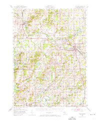
1951 Map of Hastings
USGS Topo · Published 1973About this map
The Thornapple River winds through this mid-century landscape, anchoring the development of Hastings and Middleville. This 1951 field-checked survey reveals a rural Michigan county transitioning from early agricultural patterns to a recreation-oriented landscape, as seen in the expansive Yankee Springs Recreation Area and numerous clusters of lakeside cottages around Gun Lake and Algonquin Lake. The map is particularly dense with small-scale rural infrastructure, from one-room schoolhouses like Wood Sch and Little Brick Sch to small rural cemeteries such as Bowerman Cem. The New York Central railroad corridor remains a primary transportation artery, connecting smaller settlements like Irving to the regional hub at Hastings. For the researcher, the map preserves the exact locations of vanished community centers like Schultz and Carlton Center before modern expansion altered the local geography.
Find a feature on this map
120 named features on this map. Tap any name to fly to it.
Don’t see what you’re looking for? This feature index may not catch every label — zoom into the map to look around manually.
Map Details
Editions of this 1951 Hastings Map
5 editions found

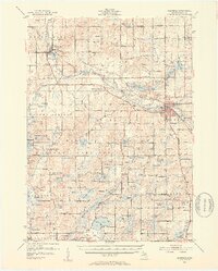
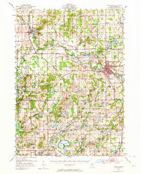

Other maps of this area

1914 · Grand Rapids
USGS Topo · 1:62,500

1916 · Kalamazoo
USGS Topo · 1:62,500

1916 · Ionia
USGS Topo · 1:62,500

1918 · Kalamazoo
USGS Topo · 1:62,500

1918 · Battle Creek
USGS Topo · 1:62,500

1918 · Ionia
USGS Topo · 1:62,500

1918 · Galesburg
USGS Topo · 1:62,500

1918 · Lowell
USGS Topo · 1:62,500

1943 · Battle Creek
USGS Topo · 1:62,500

1943 · Kalamazoo
USGS Topo · 1:62,500