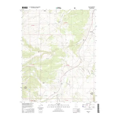
2017 Map of Hatch
USGS Topo · Published 2017About this map
The Sevier River carves a central path through this landscape, defining the valley where the settlement of Hatch is situated. This high-plateau environment in southern Utah is characterized by its proximity to the Dixie National Forest and the rugged drainage systems of Mammoth Cr and Limestone Cr. The map reveals a transition from the river bottomlands to the elevated terrain of Hatch Mtn, with numerous family-named and topographic landmarks such as Graveyard Hollow and Limerock Canyon providing specific points of interest for local history. For genealogists, the inclusion of both the Hatch City Cem and the Hillsdale Cem near the northern settlement of Hillsdale offers precise locations for ancestral research. The network of forest and local roads, including Hatch Mountain Rd and Rock Canyon Rd, illustrates the access routes through the varied elevations of the t36s r5w and t35s r5w townships.
Find a feature on this map
64 named features on this map. Tap any name to fly to it.
Don’t see what you’re looking for? This feature index may not catch every label — zoom into the map to look around manually.
Map Details
Editions of this 2017 Hatch Map
This is the sole edition of this map. No revisions or reprints were ever made.
Other maps of this area

1886 · Kanab
USGS Topo · 1:250,000

1953 · Cedar City
USGS Topo · 1:250,000

1958 · Cedar City
USGS Topo · 1:250,000

1958 · Panguitch Lake
USGS Topo · 1:62,500

1962 · Cedar City
USGS Topo · 1:250,000

1966 · Wilson Peak
USGS Topo · 1:24,000

1966 · Hatch
USGS Topo · 1:24,000

1966 · George Mtn
USGS Topo · 1:24,000
1966 · Tropic Reservoir
USGS Topo · 1:24,000

1971 · Fivemile Ridge
USGS Topo · 1:24,000