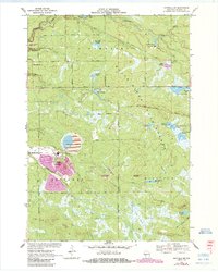
1970 Map of Hatfield SW
USGS Topo · Published 1985About this map
Black River State Forest covers much of this landscape, which is defined by a complex network of flowages and marshes. The transition from natural water bodies like Morrison Creek and Hay Creek to managed wetlands is evident in features such as Staffon Flowage, Dry Land Flowage, and Teal Flowage. This 1970s-era geography reflects both conservation and specialized agriculture, notably the Cranberry Bog situated near the headwaters of the Black River.
Find a feature on this map
45 named features on this map. Tap any name to fly to it.
Don’t see what you’re looking for? This feature index may not catch every label — zoom into the map to look around manually.
Map Details
Editions of this 1970 Hatfield SW Map
3 editions found
Other maps of this area

1924 · Black River Falls
USGS Topo · 1:62,500

1926 · Black River Falls
USGS Topo · 1:62,500

1928 · Melrose
USGS Topo · 1:48,000

1947 · Millston
USGS Topo · 1:62,500

1949 · Millston
USGS Topo · 1:62,500

1949 · Melrose
USGS Topo · 1:62,500

1953 · Eau Claire
USGS Topo · 1:250,000

1958 · Eau Claire
USGS Topo · 1:250,000

1958 · Hatfield
USGS Topo · 1:48,000

1964 · Eau Claire
USGS Topo · 1:250,000