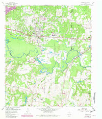
1960 Map of Hawkins
USGS Topo · Published 1982About this map
The Hawkins Oil Field dominates this corner of Wood and Upshur counties, where a dense network of pipelines and wells surrounding the Hawkins Refinery illustrates the area's mid-century petroleum economy. The Sabine River carves a meandering course across the southern landscape, creating a broad floodplain through which the St Louis Southwestern railroad passes.
Find a feature on this map
38 named features on this map. Tap any name to fly to it.
Don’t see what you’re looking for? This feature index may not catch every label — zoom into the map to look around manually.
Map Details
Editions of this 1960 Hawkins Map
3 editions found
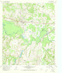
Other maps of this area

1938 · Winona
USGS Topo · 1:48,000

1943 · Winona
USGS Topo · 1:62,500

1948 · Tyler
USGS Topo · 1:62,500

1949 · Tyler
USGS Topo · 1:62,500

1956 · Tyler
USGS Topo · 1:250,000

1960 · Shady Grove
USGS Topo · 1:24,000

1960 · Hawkins
USGS Topo · 1:24,000

1960 · Big Sandy
USGS Topo · 1:24,000

1960 · Pritchett
USGS Topo · 1:24,000

1960 · Hainesville
USGS Topo · 1:24,000